THE GREAT PYRAMID PAPERS
The Solar System Model
PAPER U
March 2024
PAPER T
March 2024
PAPER S
March 2024
PAPER R
March 2024
PAPER Q
March 2024
PAPER P
March 2024
PAPER O
March 2024
PAPER N
September 2023
PAPER M
September 2023
The Giza Plateau
PAPER L
March 2023
PAPER K
December 2022
PAPER J
April 2022
The Great Pyramid
PAPER I
December 2021
PAPER H
April 2021
UPDATE
PAPER G
April 2021
PAPER F
April 2021
PAPER E
April 2021
PAPER D
April 2021
PAPER C
April 2021
PAPER B
April 2021
PAPER A
September 2020
BOOK 1
August 2010
Home Page
INDEX
The Great Pyramid's solar system map and the surveying grid of the Giza Plateau
- Solar system map
- Wall of the Crow design
- Ground markings in Sicily
- Giza baseline
- Surveyor's grid
ABSTRACT
In this paper I analyse the wall markings on the northern wall of the lower chamber in the Great Pyramid of
Giza and from that analysis identify the original surveying grid of the Giza plateau.
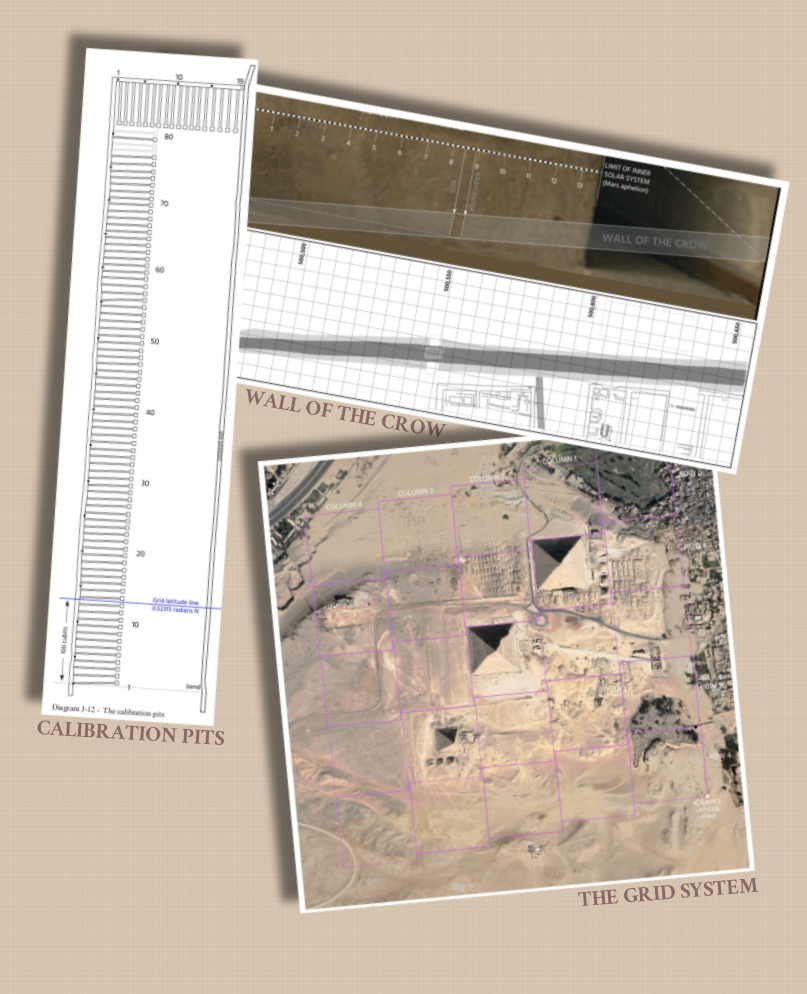
I show that the astronomical data that was uncovered on these walls in my earlier work allows two maps of the solar system that have been drawn onto this wall to be discovered. From the design on the chamber's wall I determine that the feature known as the 'Wall of the Crow', a 7m wide massive outdoor wall located on the Giza Plateau to the south of the Sphinx, has its design plan hidden in the lower chamber's wall structure in the Great Pyramid.
Using the Wall of the Crow as the start point, I show that the first astronomical line on the wall map of solar system in the lower chamber has been replicated at a scale of 1:87500 on the Earth and that the end point of this line, which can be found in Sicily some 1740 km away, is marked out by clearly identifiable features on the ground at that point. I show that the mapping system in use uses both geocentric and geodesic calculations and from this establish the original surveyor's baseline and base grid to which the Giza Plateau's monuments are all aligned.
I identify that the series of trenches to the west of the second pyramid on the Giza Plateau are an alignment mechanism for forming the surveying grid and I show that the markings in Sicily conform to the grid system in Giza and are an essential requirement for the Giza system to be solved.
I prove that this surveying grid stretches around the globe and that the pyramids of Abusir provide the alignment mechanism required for adjusting the grid to a longitude accuracy of 1mm.
 Great Pyramid Paper J - The Great Pyramid's solar system map and the original surveying grid of the Giza Plateau
I show that the astronomical data that was uncovered on these walls in my earlier work allows two maps of the solar system that have been drawn onto this wall to be discovered. From the design on the chamber's wall I determine that the feature known as the 'Wall of the Crow', a 7m wide massive outdoor wall located on the Giza Plateau to the south of the Sphinx, has its design plan hidden in the lower chamber's wall structure in the Great Pyramid.
Using the Wall of the Crow as the start point, I show that the first astronomical line on the wall map of solar system in the lower chamber has been replicated at a scale of 1:87500 on the Earth and that the end point of this line, which can be found in Sicily some 1740 km away, is marked out by clearly identifiable features on the ground at that point. I show that the mapping system in use uses both geocentric and geodesic calculations and from this establish the original surveyor's baseline and base grid to which the Giza Plateau's monuments are all aligned.
I identify that the series of trenches to the west of the second pyramid on the Giza Plateau are an alignment mechanism for forming the surveying grid and I show that the markings in Sicily conform to the grid system in Giza and are an essential requirement for the Giza system to be solved.
I prove that this surveying grid stretches around the globe and that the pyramids of Abusir provide the alignment mechanism required for adjusting the grid to a longitude accuracy of 1mm.
DOWNLOAD THIS PAPER - 24.3 Mb
Great Pyramid Paper J - The Great Pyramid's solar system map and the original surveying grid of the Giza Plateau

ISBN Registered and ©Copyright
The right of Stephen Brabin to be identified as the author of this work has been asserted by him in accordance with the Copyright, Designs and Patents Act of 1998 All rights reserved. No part of this publication may reproduced, stored in or introduced into a retrieval system, or transmitted , in any form, or by any means, (electronic, mechanical, photocopying, recording or otherwise) without the prior written permission of the author. Any person who does any unauthorised act to this publication may be liable to criminal prosecution and civil claims for damages.