THE GREAT PYRAMID PAPERS
The Solar System Model
PAPER U
March 2024
PAPER T
March 2024
PAPER S
March 2024
PAPER R
March 2024
PAPER Q
March 2024
PAPER P
March 2024
PAPER O
March 2024
PAPER N
September 2023
PAPER M
September 2023
The Giza Plateau
PAPER L
March 2023
PAPER K
December 2022
PAPER J
April 2022
The Great Pyramid
PAPER I
December 2021
PAPER H
April 2021
UPDATE
PAPER G
April 2021
PAPER F
April 2021
PAPER E
April 2021
PAPER D
April 2021
PAPER C
April 2021
PAPER B
April 2021
PAPER A
September 2020
BOOK 1
August 2010
Home Page
INDEX
The GPS location of the Great Pyramid of Giza and the puzzle on the roof
- Underground shafts
- The apex plateau
- Puzzle on the roof
- The base foundation point
- Tectonic plate movement in latitude
ABSTRACT
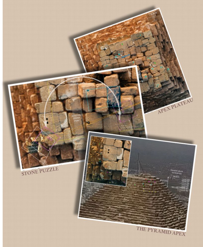
The apex of the Great Pyramid of Giza is incomplete, the top of the building being a 10 meter square
plateau of uneven stonework. It has been theorised by academics that this incomplete upper portion of the
pyramid has been destroyed by human activity since the pyramid was constructed.
In this paper I show that the apex plateau of the Great Pyramid is an original feature of the building and that the stonework of this level contains a series of rectangular and circular holes which comprise a sophisticated geometric puzzle. I demonstrate that the upper level of stonework is the 202nd level of the pyramid's core masonry and that it is located at an altitude of 202 meters above the lowest part of the pyramids construction, that being at the bottom of the vertical shaft of the underground chamber, when the meter is defined perfectly from the Earth's reference ellipsoid parameters.
I prove that the underground vertical shaft is a 2:1 scale model of the southern underground passage in the pyramid, and from that determine that the architecture of the whole building has been designed to be referenced to sea level and that the elevation of the major parts of the building can be determined through computation, rather than surveying measurements.
I solve the geometric puzzle that is carved into the apex plateau of the pyramid and thereby determine the latitude and longitude relationship between the building's lowest point in the underground shaft, the apex plateau, and the base center of the pyramid.
From this solution I determine the GPS coordinates of the base center point of the Great Pyramid on 26th February 2018 at 07.30 UTC from GPS measurements that were taken on that day by a team of surveyors. I then compute the tectonic plate shift of the pyramid in latitude since its construction by referencing the 2018 center point latitude to the pyramid's orignal latitude which is explicitly given within the building's architecture.
 Great Pyramid Paper B -The vertical chamber stack of the Great Pyramid part 1
In this paper I show that the apex plateau of the Great Pyramid is an original feature of the building and that the stonework of this level contains a series of rectangular and circular holes which comprise a sophisticated geometric puzzle. I demonstrate that the upper level of stonework is the 202nd level of the pyramid's core masonry and that it is located at an altitude of 202 meters above the lowest part of the pyramids construction, that being at the bottom of the vertical shaft of the underground chamber, when the meter is defined perfectly from the Earth's reference ellipsoid parameters.
I prove that the underground vertical shaft is a 2:1 scale model of the southern underground passage in the pyramid, and from that determine that the architecture of the whole building has been designed to be referenced to sea level and that the elevation of the major parts of the building can be determined through computation, rather than surveying measurements.
I solve the geometric puzzle that is carved into the apex plateau of the pyramid and thereby determine the latitude and longitude relationship between the building's lowest point in the underground shaft, the apex plateau, and the base center of the pyramid.
From this solution I determine the GPS coordinates of the base center point of the Great Pyramid on 26th February 2018 at 07.30 UTC from GPS measurements that were taken on that day by a team of surveyors. I then compute the tectonic plate shift of the pyramid in latitude since its construction by referencing the 2018 center point latitude to the pyramid's orignal latitude which is explicitly given within the building's architecture.
DOWNLOAD THIS PAPER - 28.3 Mb
Great Pyramid Paper B -The vertical chamber stack of the Great Pyramid part 1

ISBN Registered and ©Copyright
The right of Stephen Brabin to be identified as the author of this work has been asserted by him in accordance with the Copyright, Designs and Patents Act of 1998 All rights reserved. No part of this publication may reproduced, stored in or introduced into a retrieval system, or transmitted , in any form, or by any means, (electronic, mechanical, photocopying, recording or otherwise) without the prior written permission of the author. Any person who does any unauthorised act to this publication may be liable to criminal prosecution and civil claims for damages.